| Image 08 ECUADOR/REPU: THE GUAYAQUIL GULF An enlargement of LANDSAT TM Scene 11/62 FQ2 Dated 19/08/1991 |
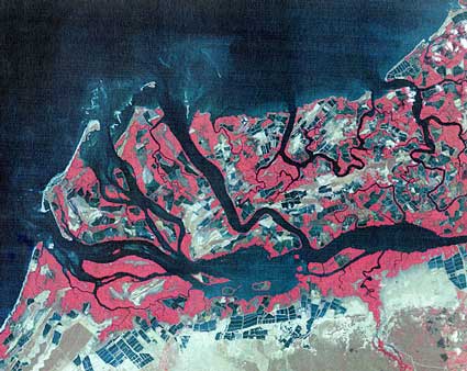 |
| Tumbes area |
| This image also, taken further north, shows very clearly the extent of mangrove forest depletion. Shrimp ponds are clearly visible. |
|
Prepared by Ms. Marie Aizpuru, and provided by Prof. François Blasco,Laboratoire
d'Ecologie Terestre(LET), Toulouse, France, for ISME |